Columns
| Column | Type | Size | Foreign Key | Nullable | Default | Comments |
|---|---|---|---|---|---|---|
| nd_geolocation_id | bigserial | 19 |
|
nextval('chado.nd_geolocation_nd_geolocation_id_seq'::regclass) | ||
| description | text | 2147483647 |
|
√ | null | A textual representation of the location, if this is the original georeference. Optional if the original georeference is available in lat/long coordinates. |
| latitude | float4 | 8,8 |
|
√ | null | The decimal latitude coordinate of the georeference, using positive and negative sign to indicate N and S, respectively. |
| longitude | float4 | 8,8 |
|
√ | null | The decimal longitude coordinate of the georeference, using positive and negative sign to indicate E and W, respectively. |
| geodetic_datum | varchar | 32 |
|
√ | null | The geodetic system on which the geo-reference coordinates are based. For geo-references measured between 1984 and 2010, this will typically be WGS84. |
| altitude | float4 | 8,8 |
|
√ | null | The altitude (elevation) of the location in meters. If the altitude is only known as a range, this is the average, and altitude_dev will hold half of the width of the range. |
Table contained -1 rows
Indexes
| Constraint Name | Type | Sort | Column(s) |
|---|---|---|---|
| nd_geolocation_pkey | Primary key | Asc | nd_geolocation_id |
| nd_geolocation_idx1 | Performance | Asc | latitude |
| nd_geolocation_idx2 | Performance | Asc | longitude |
| nd_geolocation_idx3 | Performance | Asc | altitude |
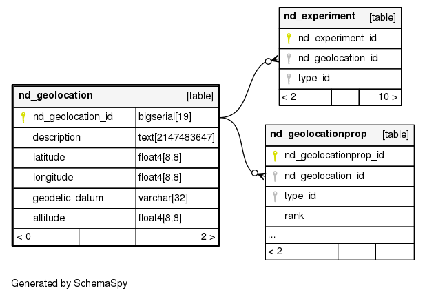
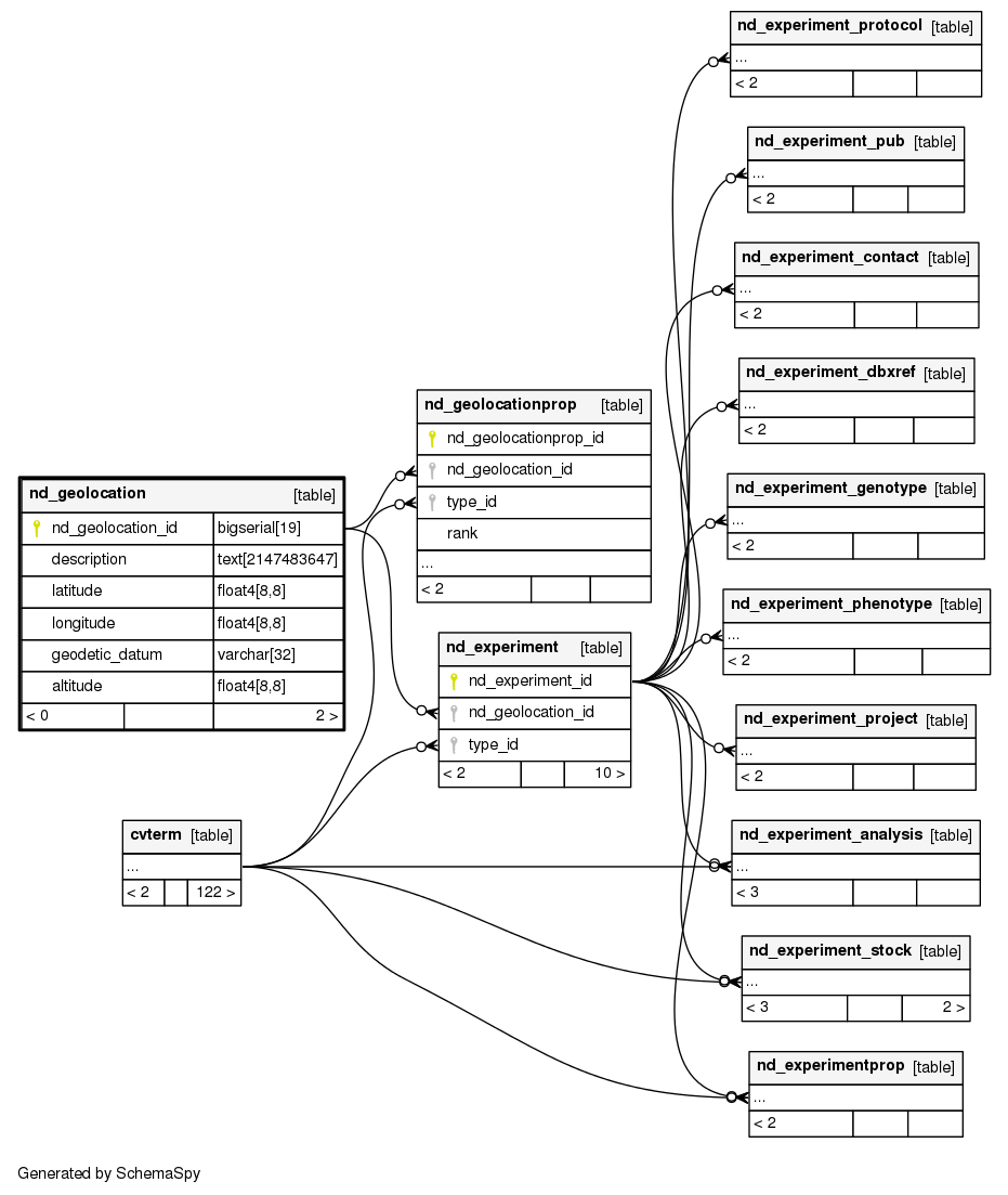
Relationships
The following entity relationship (ER) diagram shows the relationships involving the nd_geolocation table.
Show relationships within degrees of separation